
Outer Hebrides – 6 – Isle of Lewis
Tuesday 16th – Journey from the Harris Hotel up through the island to Borve House Hotel, Lewis

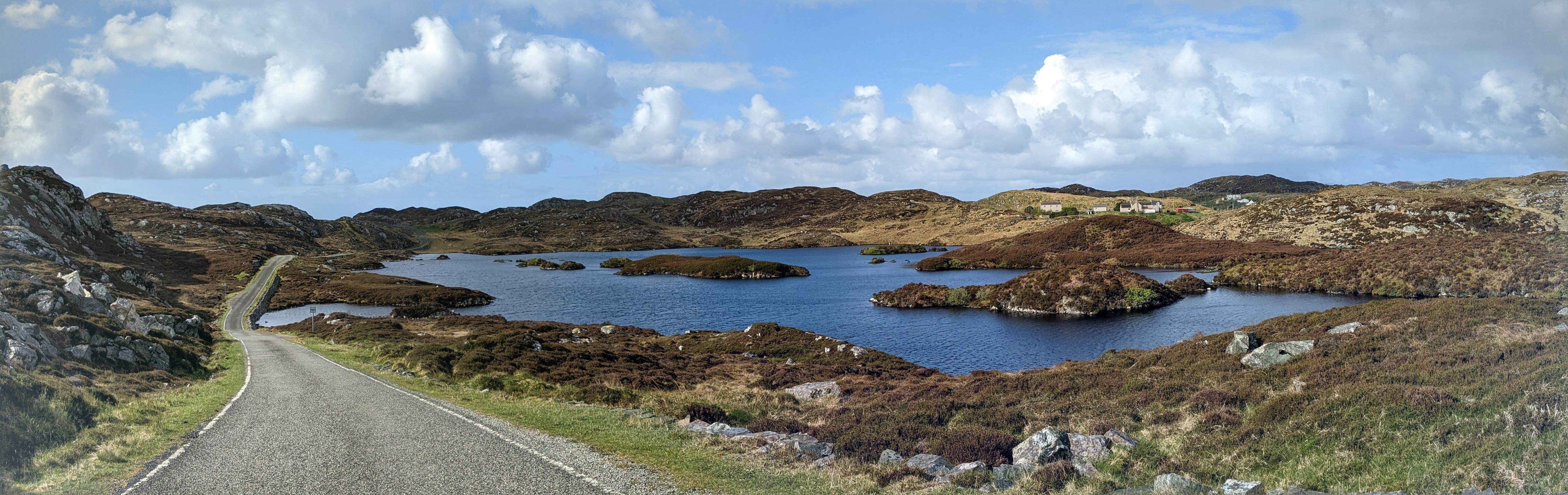
We weren’t really prepared for what a large place Lewis is. Or for the fact that once you get much above the half of the island which is Harris, most of the interest in Lewis appears to be round the edges.
Although on arriving from the Southern Islands we had been immediately struck by the evidence of increased prosperity – almost none of the deserted or ruined buildings, almost none of the abandoned and rusting farm and other machinery that on the whole tourists don’t care to photograph..
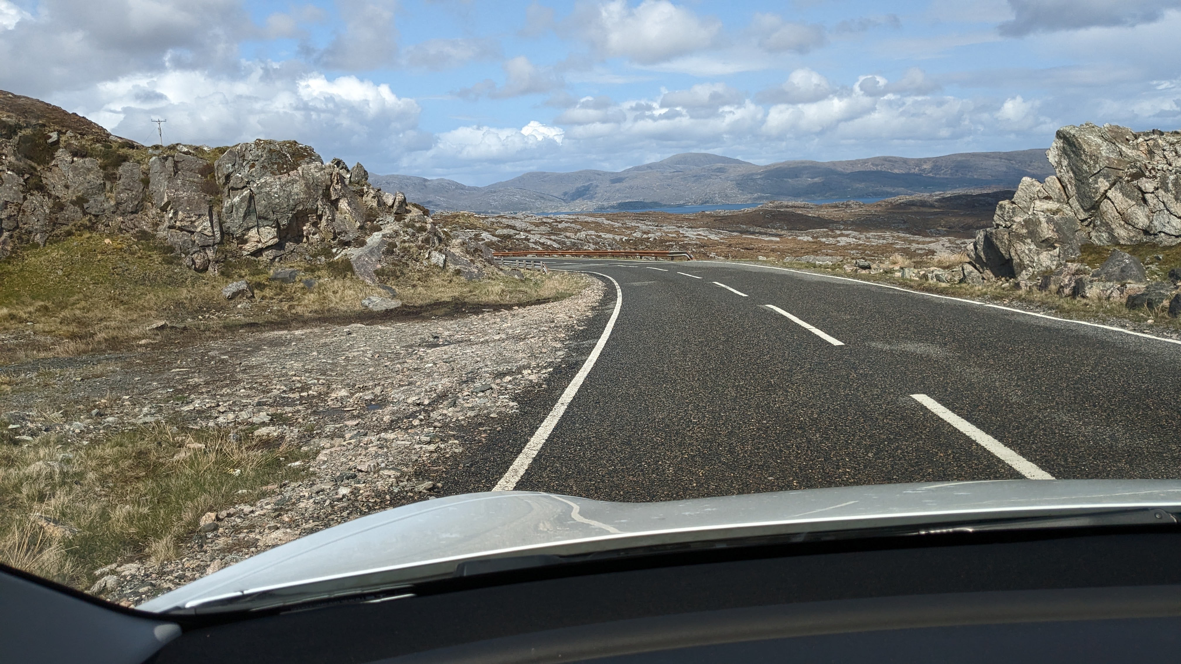
But after the beautiful hills and mountains of Harris, the central area of Lewis appears to be a huge expanse of more or less uniform peat bog. Which has its own fascination, but would be an heroic trek for anyone determined to complete the Hebridean Way on foot. Bicyclists were a different matter, although for them it is tough going as well, but there were a great many of them doing the trip.

Ancient sites along the way spoke of the milder climate in the Hebrides many centuries ago. The.Standing Stones of Callanish are 4,000 years old – older than Stonehenge – and the visitor centre and museum at the site did a good job of telling the various theories about the significance and purpose of the site. Two avenues of stones, one long and one short, crossed at what was clearly some sort of ceremonial centre. We checked the orientation of the long axis out of curiosity and found it ran towards the SSE. The stones themselves were more of the ancient gneiss rock, naturally grained and patterned and very beautiful, especially when the sun broke through the scudding clouds.
We were told that the visitor centre has been awarded a six million pound grant for upgrading, which was a bit eyebrow-raising. Let’s hope the stones are not going to be roped off from visitors as Stonehenge has been – although of course that was for excellent reasons. Progress, and all that.
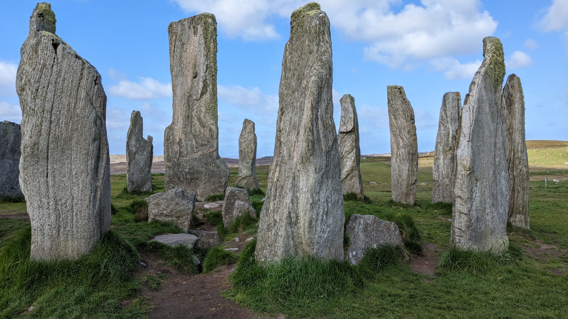


Please expand the above pictures to get a getter idea.
The second visitor attraction along the way was the Iron Age tower of Carloway Broch. A mere 2,000 years old, this is a surprisingly sophisticated structure of double-skinned dry stone walls, with staircases inside them giving access to what were once upper floors.
This site was even less regimented than the standing stones, and you could go inside through the very low entrance, through another doorway opposite into the space between the walls. and climb up the first flight of the staircase.
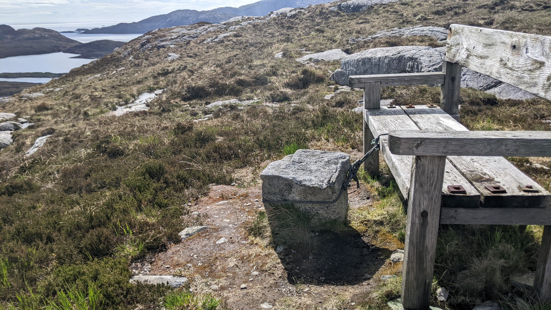
It had turned into a sunny afternoon and the close turf was delightful to walk on. There was a steady, spread-out stream of visitors, but I was the only one who climbed the hillside behind to see and photograph the view from above.


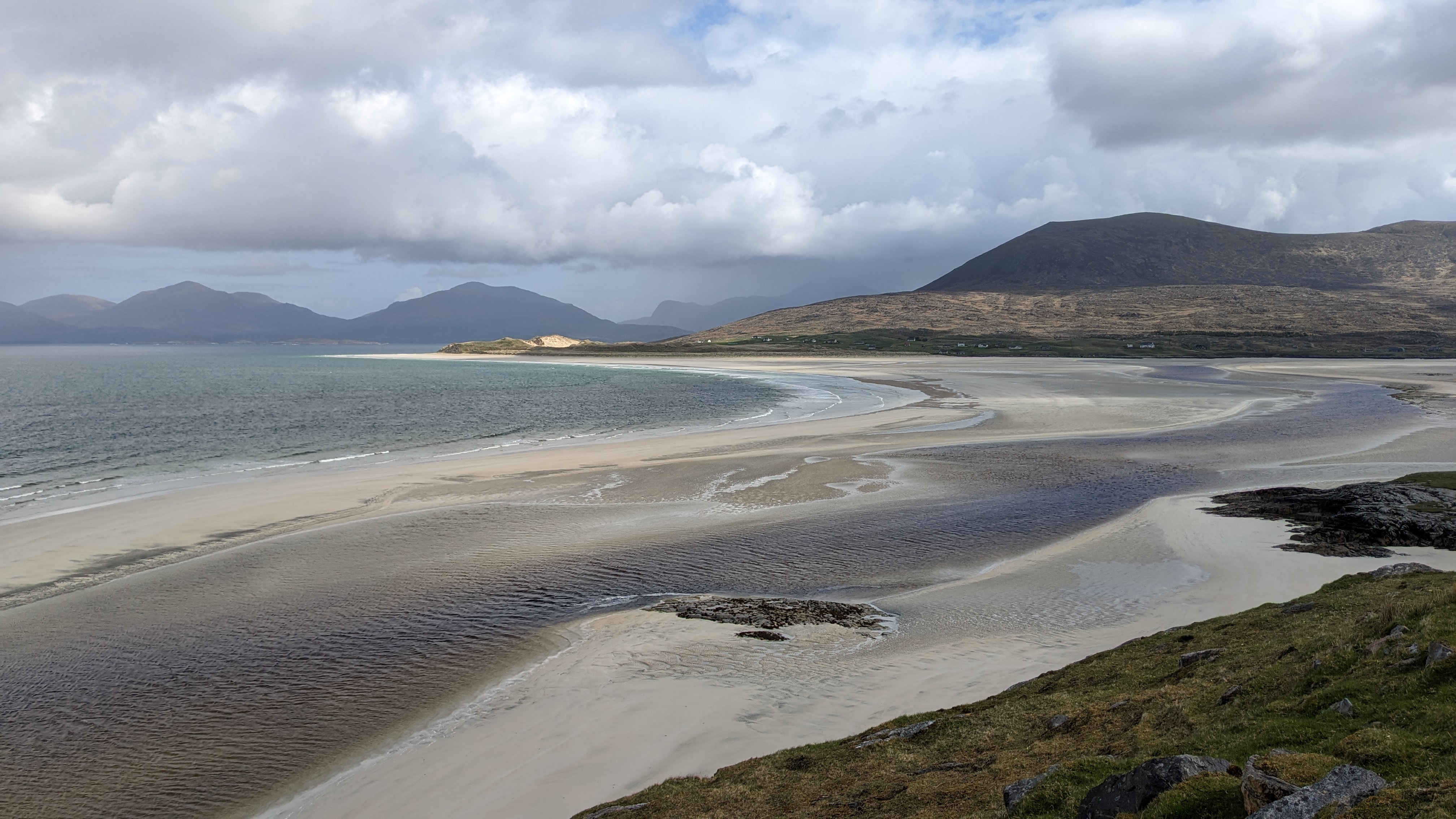
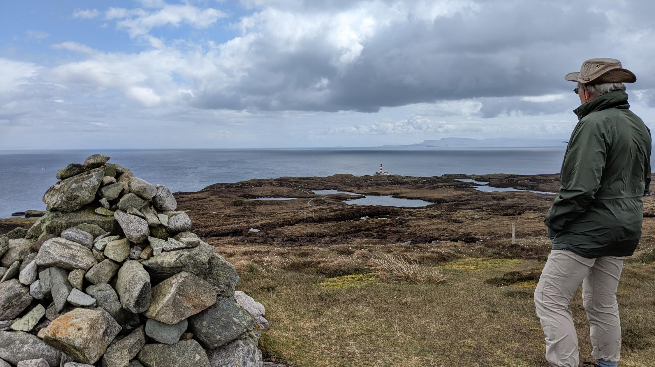
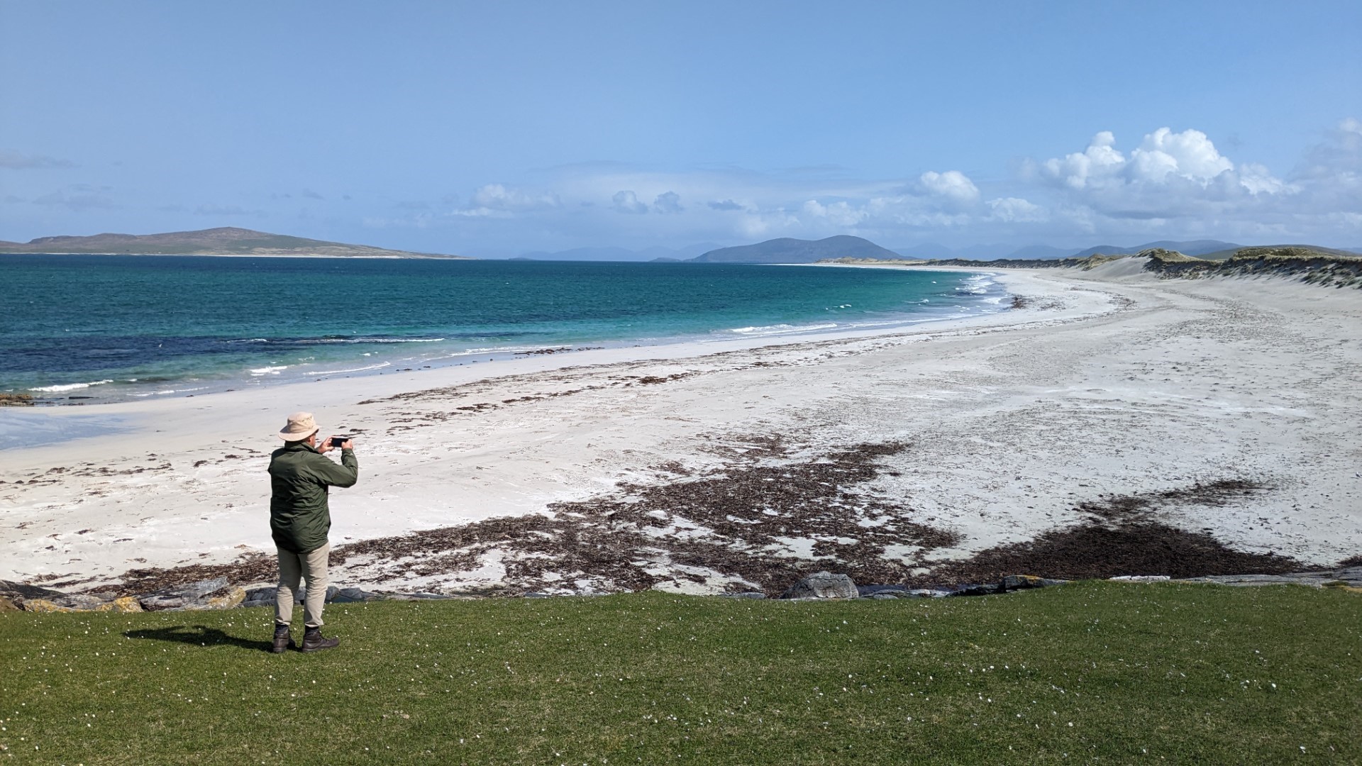
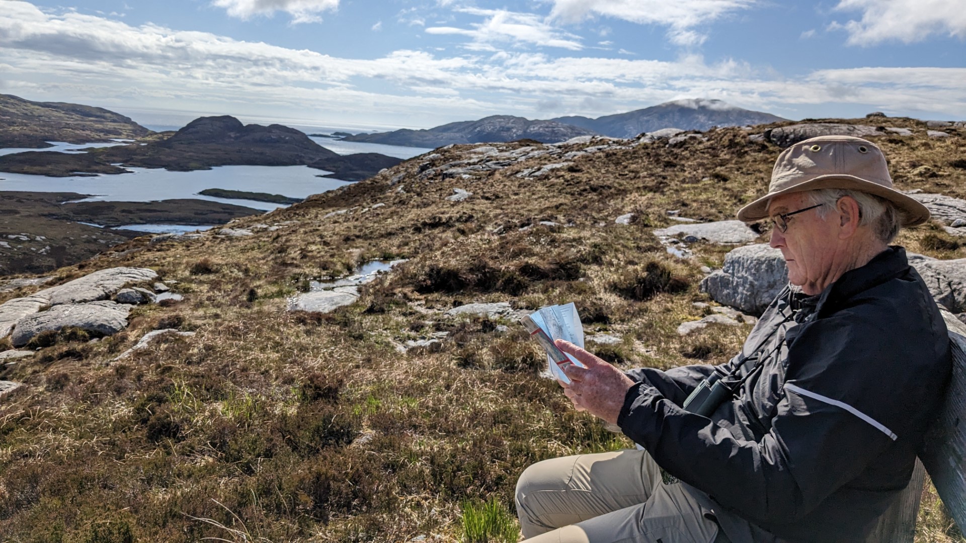
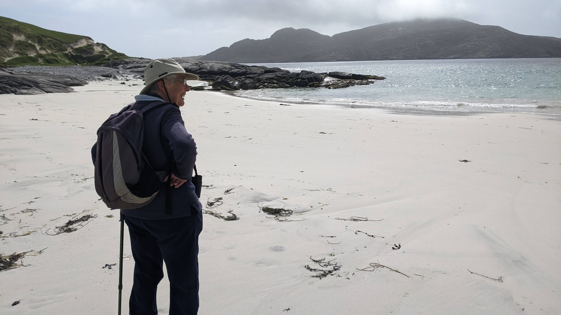
From there we pressed on, past what was to be our hotel for the next two nights, to the northernmost point of our journey – the Butt of Lewis lighthouse. After mile upon mile through almost uninhabited country we came to a string of relatively heavily populated habitations at the very top of Lewis: South and North Dell, Swainbost, Habost, Lional and Eoropaidh. We wondered what on earth so many people could find to do up there, but were assured by a local that employment there was good.
The Butt of Lewis is known as one of the wildest and windiest places in the British Isles, but we found it, and its lighthouse, on a beautiful day. It was a lovely place, with intricately-folded metamorphic gneiss rocks, crashing waves, and seabirds, which we recognised as fulmars, roosting on the sheer rock faces in pairs who seemed to spend much of the time billing, though not actually cooing.


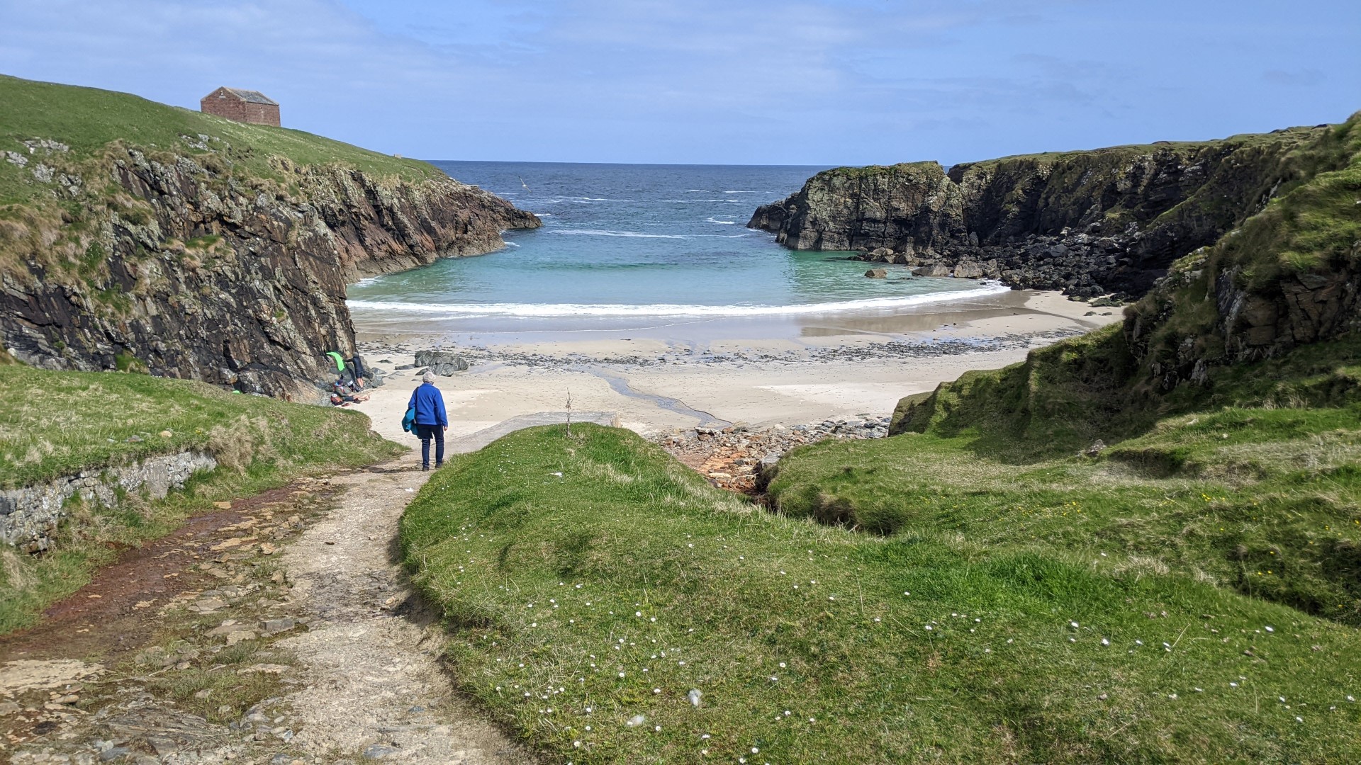
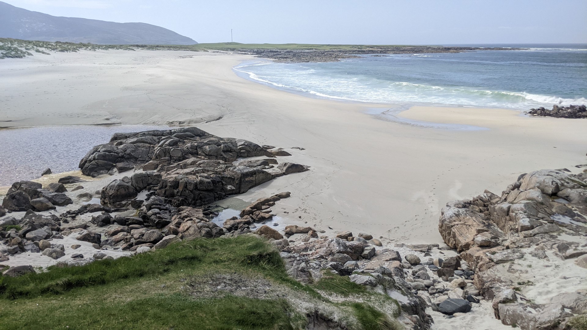
Having sat and walked on the short grass and talked to the cosmopolitan visitors, we started back along the road and almost immediately stopped above a little bay to which we descended and Lesley had a paddle in the sea.

The hotel was rather strange and did not live up to its star rating for us. Although it probably ticked all the boxes for a modern building it had fire doors every few paces in narrow corridors with no pictures on the walls, and for us it seemed soulless. Certainly in comparison with the more traditional hotels we stayed at and no comparison at all to the two B&Bs further south.
Wednesday 17th
The weather was deteriorating by the next morning, and we set off to have a look at Stornoway. With a population of around 9,000 it is by far the largest town in the Outer Hebridean chain. The general feel was much more like a mainland town, and a prosperous one at that, with streets of large well-built houses.
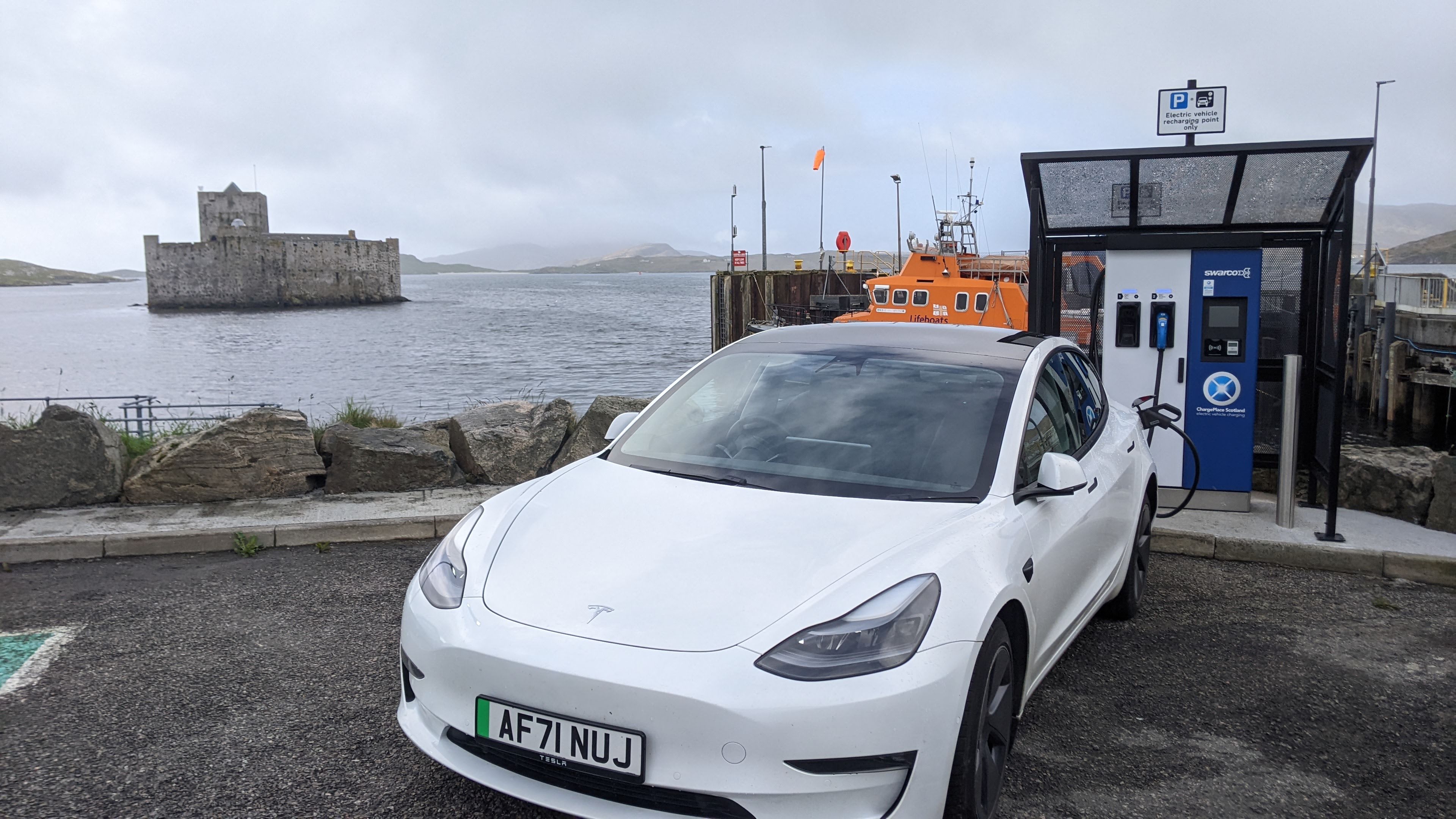
But at the same time much of it felt quite run down, and quite grey, It may have been the weather, and another frustrating experience with a charger, but we felt quite dispirited. But we found a Guardian, and the same day’s at that, and sat reading it in the lovely public library which had a delightful young woman librarian who allowed us to use the toilets which were marked ‘staff only’. Which was a good thing because the only public toilets were closed for renovation.
With the car fully charged – yes, I’m afraid I have to admit that doing this trip with an electric car, even one with a big battery like ours, charging does form a constant background preoccupation, and I would be misleading you if I didn’t include this aspect – with the car fully charged, we made our way to the castle and its modern museum, with a film of Hebridean landscape scenes projected onto three large walls, with no narration – just the sounds of nature. The museum continued with well-curated displays of aspects of Hebridean and Gaelic culture and history. Then we had a light lunch in the excellent cafeteria.
Heading west across the moor, on 17 miles of narrow, single-track road, we came to the village of Gearrannan – where a picturesque group of old Black Houses has been conserved to illustrate the very simple conditions in which the crofters lived, often with their livestock at the downhill end – helping to heat the building. At the end of the winter they would apparently take down the end wall, clear out the manure and bedding, and spread it on the fields.
The last families were moved into council accommodation as recently as the 1970s and fortunately it occurred to someone to preserve the village as a record.
The interior of one of the houses has been fully restored, with even a peat fire burning brightly in the grate,
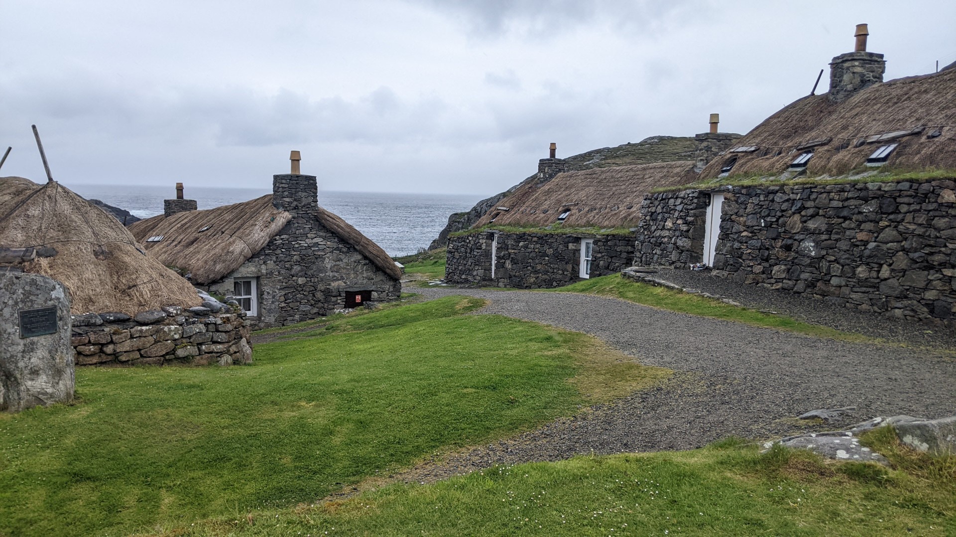


At the other end of the building there was a demonstration of the weaving of Harris Tweed.- a traditional occupation of the villagers. This wonderful character was there six days a week patiently demonstrating to a constant stream of inquisitive visitors.
In the evening we decided to eschew the hotel restaurant, braving the rain to drive 10 minutes up island to The Cross Inn which was situated in what was little more than a scatter of houses called, unsurprisingly, Cross.
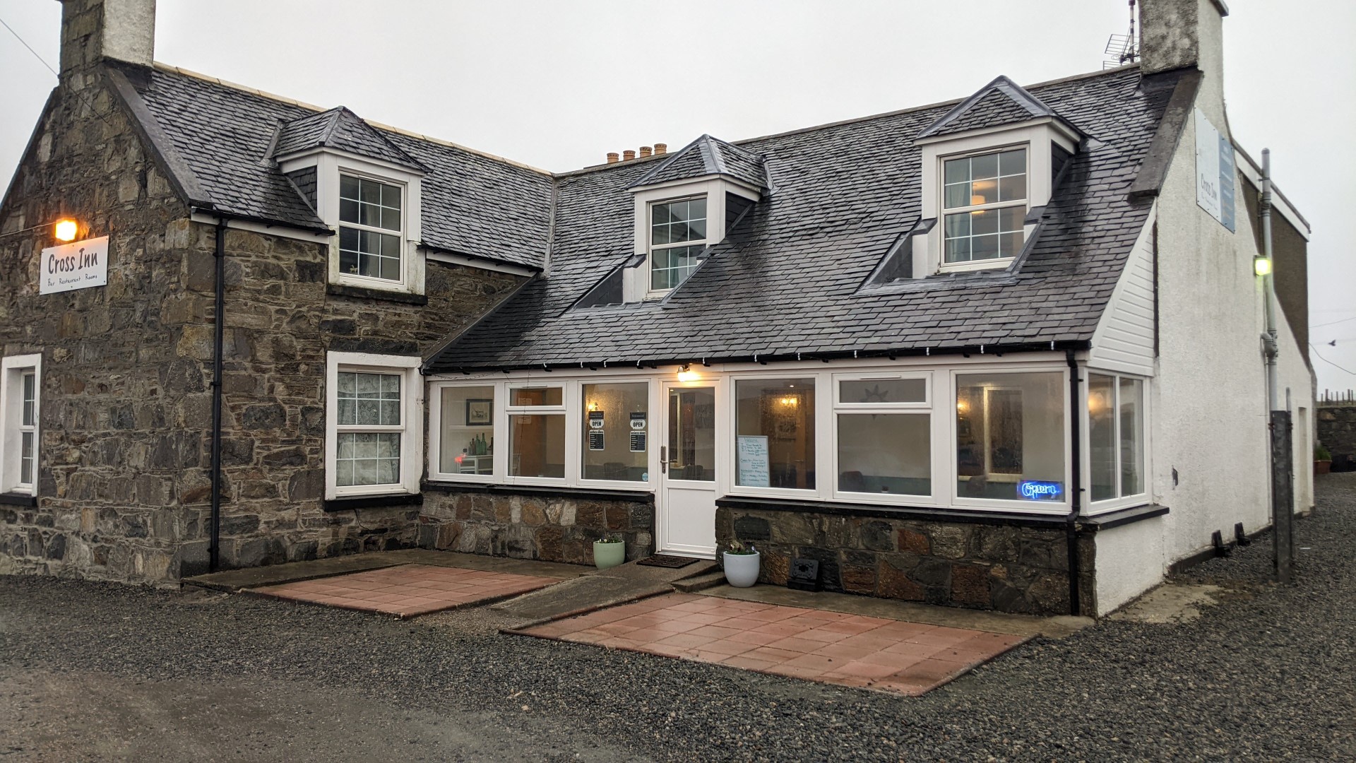
This was a warm, cheerful and bustling place and suited us fine. As elsewhere, it was a perfectly decent meal, though scarcely memorable. I finished off with a single malt, in valediction to an extraordinary trip, and Lesley drove us back to the hotel.

Completed in the next post…
The Outer Hebrides – 5 – Harris
Harris is roughly the southern half of the northernmost, and by far the largest, island in the Outer Hebridean chain. Quite why the upper and lower halves of this island have different names – Lewis and Harris respectively – is far from clear (nobody suggests England and Scotland are different islands). But anyway, the part of Harris you arrive on from the South is connected to the rest of Harris by a narrow isthmus, and it is there that the small town of Tarbert, and the Harris Hotel we stayed at, are situated.
Another delightful contrast: this is an almost old-fashioned hotel, with high ceilings, gracious and comfortable public spaces, white linen on the tables, well-maintained gardens in front, and so on.
Tarbert itself is a slightly run-down sort of place. It is yet another ferry terminal, and road works to improve the marshalling area, next to the impressive distillery with its hundreds of casks (presumably empty) lined up outside, rather dominated the walk from the hotel to the centre, such as it was.
Having set out boldly without coats to explore the place we only avoided being caught in a heavy rain squall by walking back as rapidly as we could.
Sunday 14th – The Golden Road
Before exploring Northern Harris we decided to go back and take the ‘Golden Road’ which winds along the eastern coast of South Harris and which some more knowledgeable travellers had chosen as their route up from the ferry the day before. It was a stunning drive:
From there we re-joined the main road and headed for a charging station, marked on the app as being in a small commercial area high above Seilebost beach.
This charger turned out to be the same type of smaller model, requiring the car’s on-board connecting cable, which I had failed to make work in Castlebay. And once again I found myself landed in endlessly circling instructions on its little screen, just as a perversely-timed rain flurry took the rest of the fun out of the occasion.
After which experience, even though the battery was still half full, topping it up became a priority. So when we got back to Tarbert the first thing we did was put the car on a charger – successfully. But another perfectly-timed downpour soaked me as I did connected up so that we were thoroughly wet when we darted into the hotel opposite in search of coffee. The staff inside declined any payment for the cakes we chose with our coffee, so we must have looked in a pretty sorry state as we hung our things on the radiator to dry.
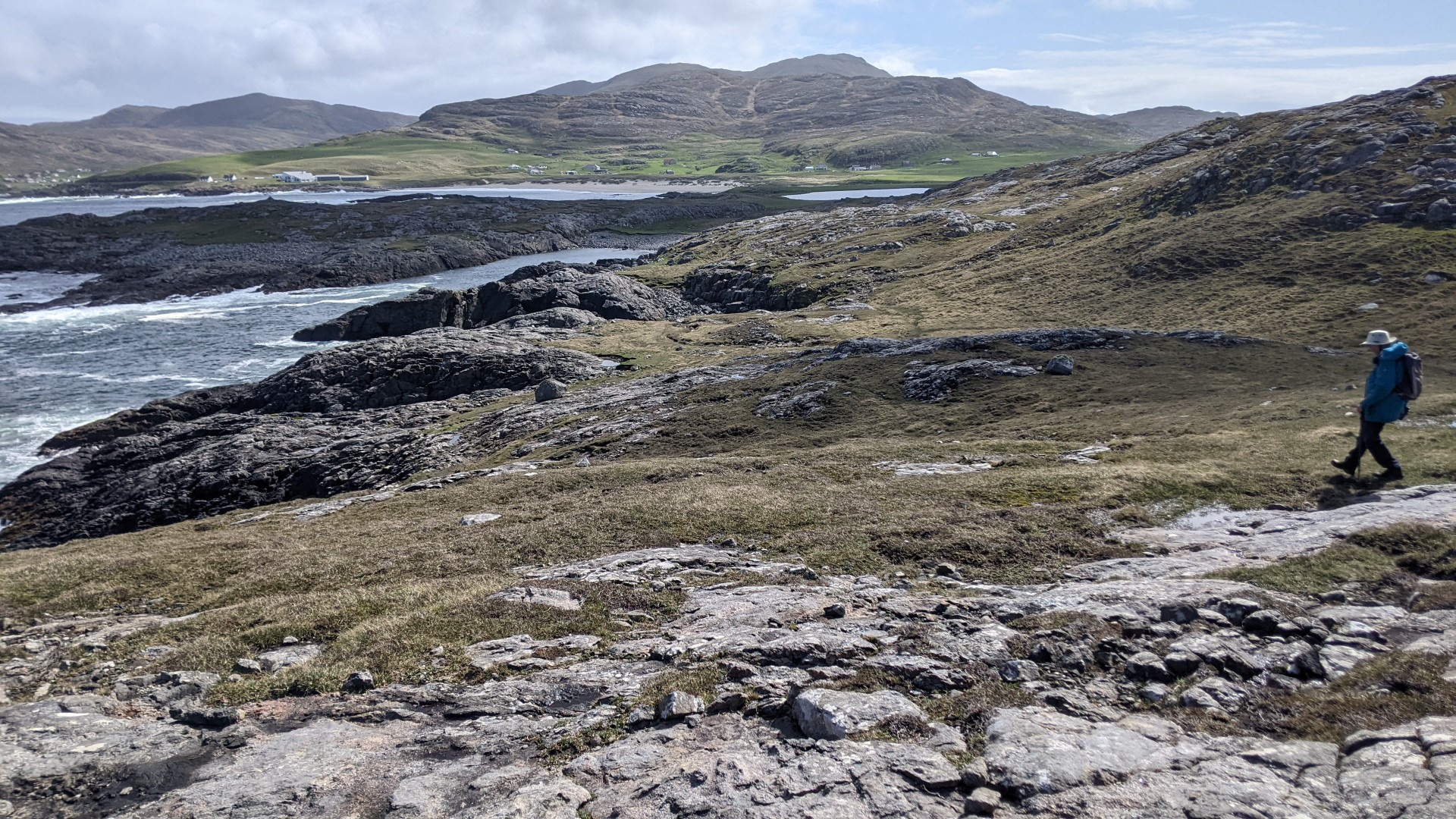
Our Eilean Glas lighthouse walk on Skalpay island
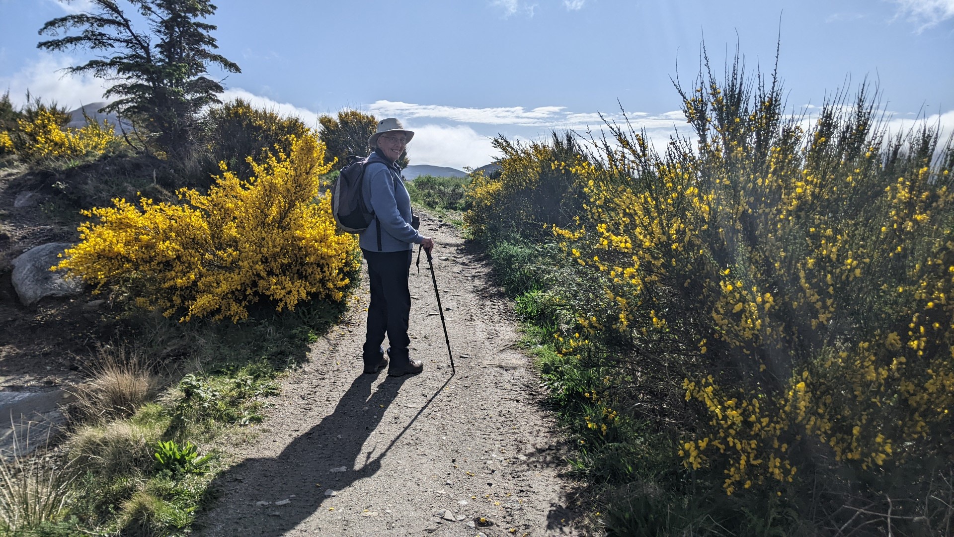
The forecast for the rest of the day was fine so we decided to visit the Eileen Glas lighthouse, strongly recommended by one of the couples we had got to know through several meetings as we moved up the islands. But we misunderstood their description and assumed they had approached it via one of the walks we found on the Walkhighlands website.
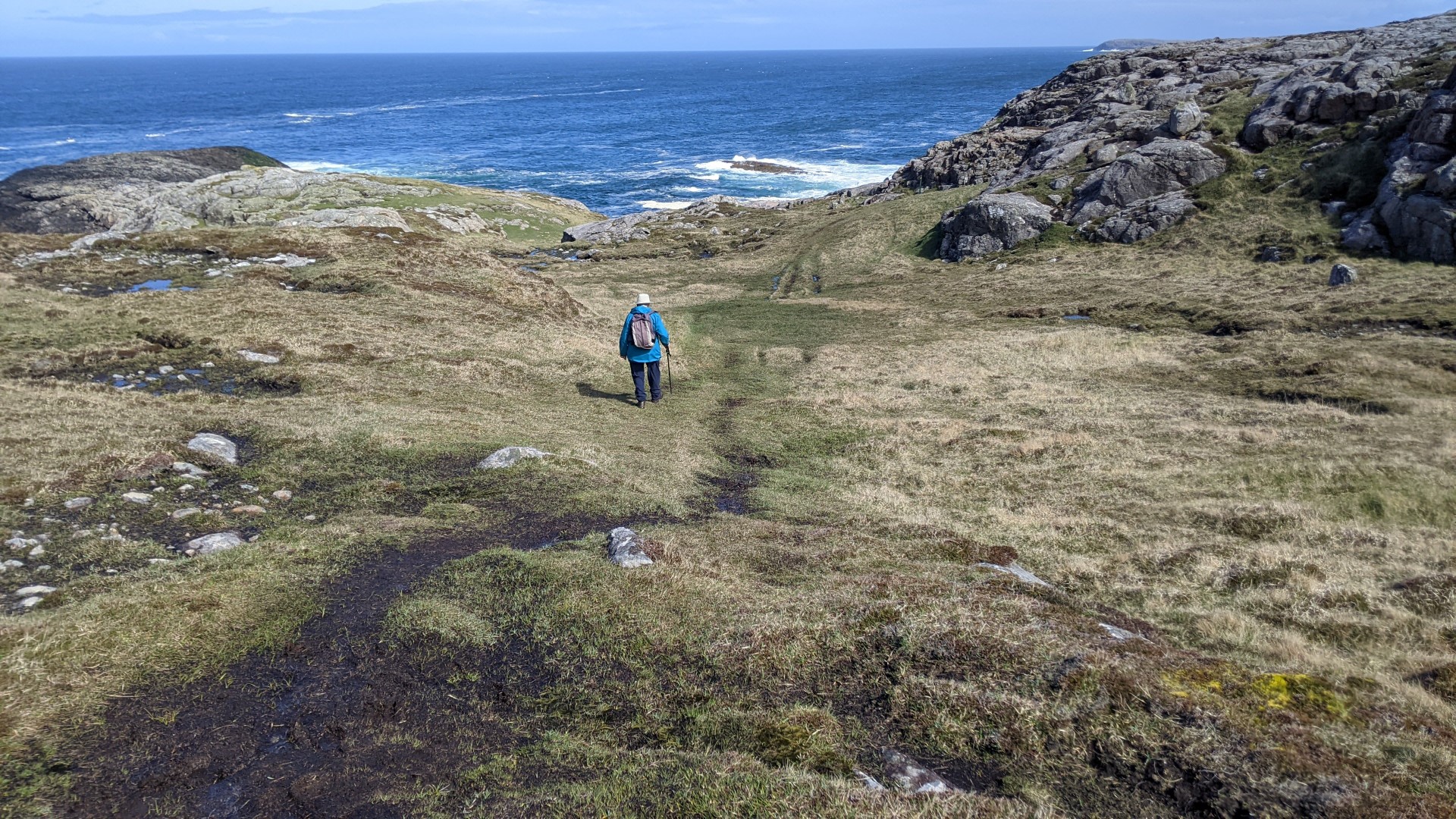
So basically we underestimated what we were taking on, to the extent that I persuaded Lesley we wouldn’t need the coffee, water and snacks that we usually carried on our walks. But after walking for an hour and a half and nearly three miles of rough, steeply up and down peat hags, there was no sign of the lighthouse and I was wondering whether it would be more sensible to turn back.


…which would have been a big mistake – Fortunately Lesley was made of tougher stuff and we made one more ascent to a cairn from which we could at last see, not only the lighthouse, but the track our advisers had actually used which would afford us an easier, if still lengthy, way back to the car.
The couple who have owned and managed the lighthouse for forty years, staff the café there every day of the summer, living in isolation and having to carry everything half a mile from the road. Definitely something to enjoy while it lasts.


The walk back to the car along another winding and hilly road was tiring and we were very glad not to miss the way back to the car. Nearly seven miles in those conditions is quite enough for us now, but we were so very glad to have done it.

The Outer Hebrides – 4 – Benbecula & North Uist

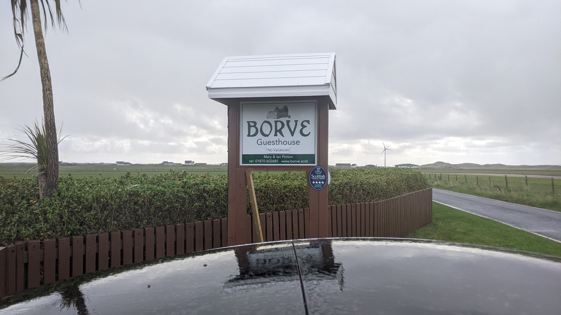
I have to tell you about the places we stay, because they are such an important part of the trip. We had been assured by both Margaret in South Uist and by the assistant in the Hebridean Jewellery Centre, when we told them where we were heading next, that we ‘would be alright with Mary’. And so indeed we were.
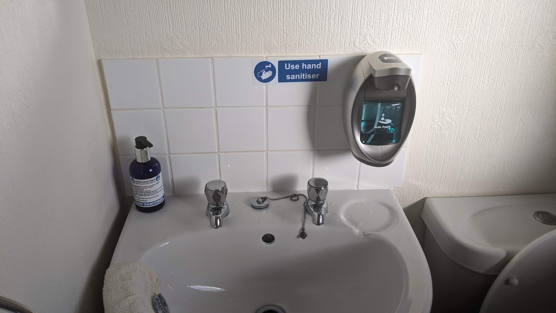
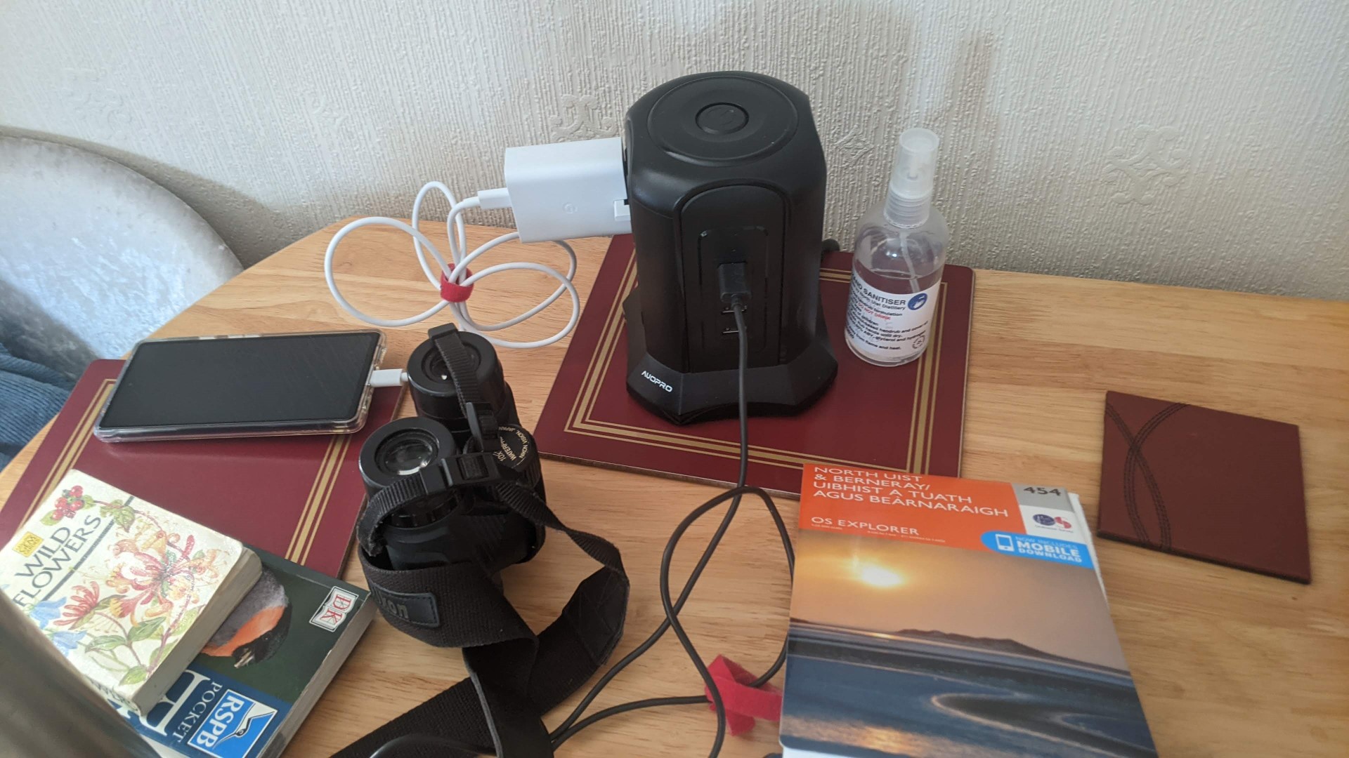
It later transpired that one of her two dogs had died at the vet’s the day we arrived (and the other hadn’t got out of its bed since) but she gave us the most wonderful welcome in spite of this. Another tremendous character, she had simply not missed a trick in providing facilities for our comfort and convenience, including a no-touch automatic soap-dispenser in the bathroom, if you please, and a power hub with no less than six power sockets and four USB charging points. Wi-fi, as everywhere we stay, is a given, and the password is almost the first item in every welcome.
Mary’s Borve Guest House logo was on welcome card, biros, wrappers round table napkins, and even on the disposable paper covering for the fresh butter in the pat. She told us she had burnt it onto the wooden table mats herself with a kind of soldering iron as something to do during lockdown (no photo – sorry!).
As before, we went for supper both evenings to a hotel about half a mile down the road – this one was the Dark Isles Hotel. And this time it looked a little further and we drove, offering a lift to two fellow guests the first evening, for which they were very grateful. We shared a table with them, two agreeable English ladies, who revealed knowledge of gin.
The excellent waiter was Romanian, and when we expressed surprise that he had found his way to South Uist he said he really liked it here, having tried Bath for a number of years. The dining room was a busy place and the sound of wild revelry burst through the door from the public bar every time it opened. Our waiter explained cheerfully that it was noisy music and noisy people. They were still at it when we left. And the second night was quieter.
Saturday 13th
We thought it would be wise to top up the car so, once we had had Mary’s sumptuous breakfast, we started the day by finding the charging unit marked on the Chargepoint Scotland app as being, improbably, in front of the school next to the hotel where we had eated the night before (which would obviously have been a good time to use it!) and found it already occupied. So we set off for the day up the island of Benbecula, where, as on South Uist, the mainly single track but beautifully-surfaced road wound and undulated through relatively flat land studded with innumerable lochs.
Reaching and crossed the causeway onto North Uist we made straight for the ferry port of Lochmaddy where we were directed by a workman to the charger down by the quay where upgrade works were in progress, so we were able to leave the car on it for an hour. Leaving, as it turned out, Lesley’s phone in it, so that, amongst the obvious communication difficulties, the car ‘thought’ she was still in it (Bluetooth, in case you wondered) and never locked. Not that that seemed the slightest danger in these parts.
Anyway, we repaired to a lovely little, modern, gallery, shop and museum a short distance away, where we installed ourselves while I walked a little further up the hill than I expected to the local shop in search of a newspaper (Lesley didn’t know where I’d gone, hence the aforementioned communication difficulty). Reaching the tiny general store I learned that the plane with the nationals had not yet arrived from the mainland, so I came back with a Stornoway Gazette, from which we read of chaos in the Caledonian MacBrane ferry services disrupting the tourist industry which was now to be hit by a savage hike in business rates.
From Lochmaddy, with the ring of confidence afforded by 300 miles in the battery, we continued anticlockwise around the top of the island towards another bird reserve. On the way I suddenly recognised a conspicuous tower on an island as having been next to a farm on North Uist on a recent Countryfile on BBC television, featured because it had been taken over and was being run, unaided, by an utterly-extraordinary 17 year old lad.

As I stood by the car to take the above picture a woman with a stout walking pole and tweed headband came striding up the hill and I couldn’t resist sharing my discovery. She was delighted: “Oh, you mean Archie!”. It turned out she was a local and it was obvious they were proud of him.
When we got to the bird reserve we happened to be comparing notes about the birds with another local, and when I mentioned that we had seen the famous farm back down the road he said that the woman running the campsite at the reserve was Archie’s Mum. Small world. Lovely people.
Anyway, we had a superb walk around a complicated shoreline in very strong wind. Here we did see a lot of birds, a shag and a number of eider ducks on rocks, and lapwings, greylag geese, arctic terns and great flocks of dunlin which we tried not to disturb on the grassy slopes. And turnstones on the shore.

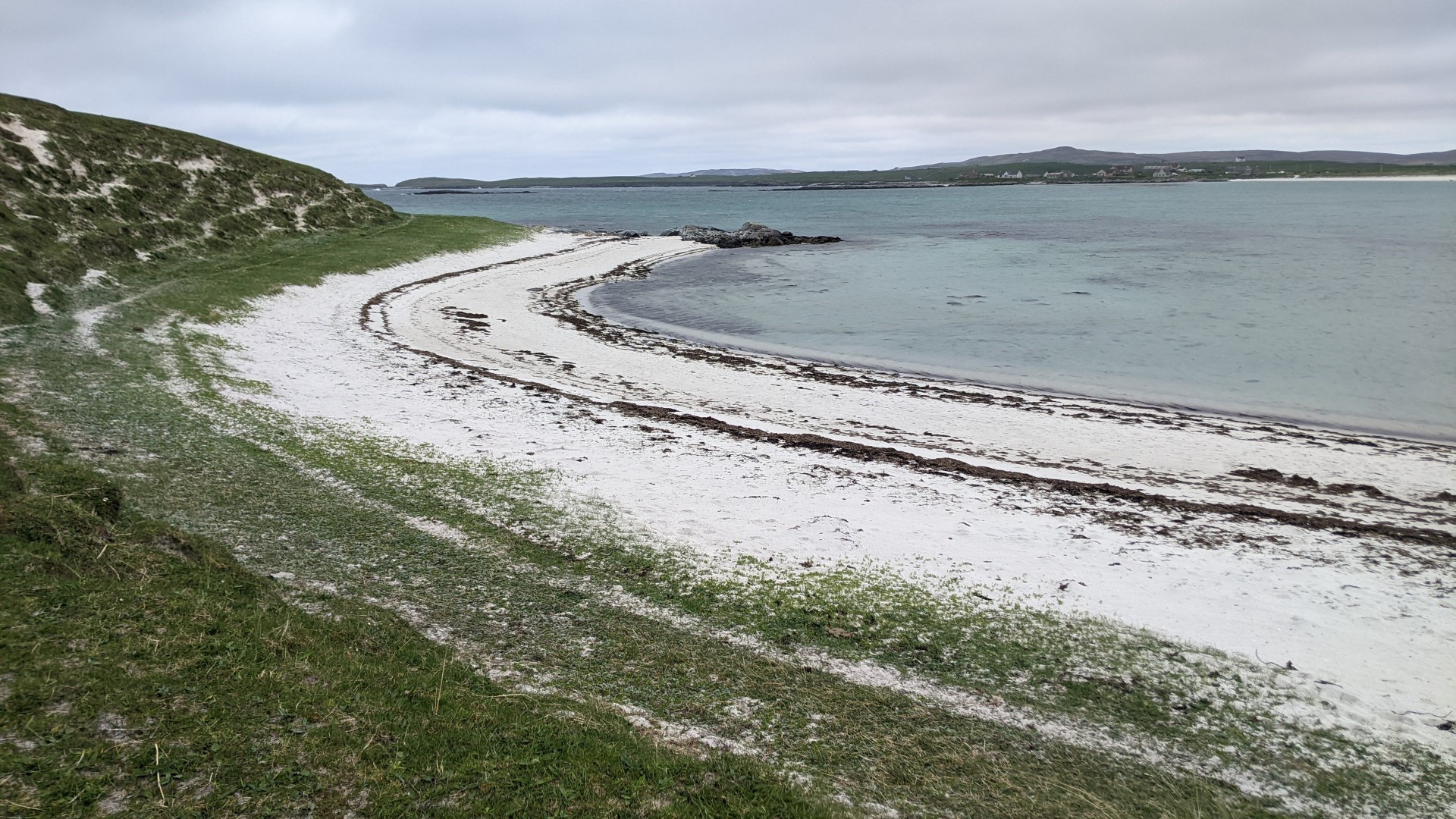


It was quite a tough walk for us and we got back to the car glowing from the wind.
Sunday 14th
Saying goodbye to Borve Guest House we drove back up through Benbecula, anticlockwise around North Uist past Lockmaddy and right at the top across yet another causeway onto the small island of Berneray where there was another ferry terminal from which we were going to cross the Sound of Harris in the early afternoon.
Wich left us plenty of time, on yet another sunny day, for another coastal walk.
Joining the ferry queue early I passed the time chatting to group of bikers about the practicalities of EV motoring, agreeing that it, or something like it, had to be the future, but they hadn’t got it entirely sorted yet,
According to my friend Alec, who skippered our four cruises in the past, the Sound of Harris. with its profusion of obstacles, involves probably the most intricate pilotage on the entire Western coast. The ferry, he told me, has to make 25 changes of course in the crossing, which was very apparent as we watched from high above the car deck (still having to cancel the car alarm with the app!)

We were third car off the ferry (that’s the front of our car in the picture – next to the bikes) and drove up the mountainous and incredibly beautiful west coast, stopping with others to look down on the beaches of Seilebost and Luskentyre.


to Tarbert where we checked in to the Harris Hotel.

Continues in the next post…

The Outer Hebrides – 3 – South Uist
Thursday 11th
Our accomodation on South Uist was a total contrast after the Castlebay Hotel.


Run by Margaret, very much a local girl, but one who had travelled the world in her time. She was a perfect hostess, extremely friendly and informative, she provided the most lovely breakfasts.
For meals on both the evenings of our stay we walked ten minutes along the road to the curiously-named Borrodale Hotel, with lovely views across the fields on our way home.

I loved driving on the beautifully smooth, undulating, single-track roads
For our first day on South Uist we took advice and went to an area which had been planted with woodland by the landowner. Wandering through we found ourselves on a path leading up the hillside close under the imposing bulk of Beinn Mhor.. This turned into another wonderful walk which took us up to a massive wooden bench which had been lashed to a rock – showing that the peaceful sunshine we were enjoying was far from the rule in those parts. We watched what we are almost certain was a Golden Eagle climbing a thrermal overhead, and then took a stile over a deer fence and scrambled through rough peatland to the summit, where we had views to the sea on the east and on the west.


Following us up were an Australian couple, the only people there apart from us, and inevitably we found we had common ground to marvel over. Meeting people is such an important part of the pleasure of these trips. We met them again over coffee at the Heritage Museum with its exibits of the hard life of the Hebridean Crofters, who were summarily moved from the good land when the rich owners decided to clear it for sheep or shooting. Sombre indeed.
Friday 12th
Friday was moving on day again, so we said a very fond goodbye to Margaret and headed north, to a Royal Society for the Protection of Birds (RSPB) reserve from which we could look back and see the profile of Beinn Mhor in the distance to the South. Curiously, there was no indication of scale on the fading map in the little car park,

and it seemed a long walk down the road before we even got to where the marker posts led us off across the peatland, up the hillside and around the loch. It was a pleasant walk, sunny and warm enough for us to gradually take off layers, but we hardly saw a single bird.


An additional attraction for me was that I could see from the map that the little road we were on led to the nearest point it was possible to reach to the most iconic of all my memories of my Hebridean sailing trips – Wizard Pool – and I was keen to try to get a nostalgic glimpse of the spot from which we watched the sunset, entirely alone in our anchorage, to the strains of Elizabeth Schwarzkopf singing Strauss’ Four Last Songs. So when the track eventually led us back to the road Lesley hit on the clever wheeze of her walking gently on while I marched back, twenty minutes or so along the road, to pick up the car.

Pressing on to the top of the island we called at the Hebridean Jewellery where we had soup, bought a Celtic silver pendant, and had a close encounter with a corncrake in the car park, one of the rarest of British birds, now almost confined to the Hebridean islands.
Crossing the causeway onto our next island, Benbecula, we found our way to the Borve Guest House, where we were greeted by another lovely hostess, Mary.
Continues in next post…

The Outer Hebrides – 2 – The Isle of Barra
After a full cooked breakfast at the hotel I went out to put the car on a charger. The Chargeplace Scotland app showed two in Castlebay, one, just across the road outside the Council Offices, looked pretty tatty and although it recognised my card the instructions just took me round and round in circles. I may have been doing something wrong but a member of staff arriving for work said that people did seem to have trouble with it, so I went down to the more modern-looking one at the ferry terminal and that started charging fine. It said it would take 50 minutes to full, so I left it going and walked up the hill to pick up Lesley from the hotel.
She had selected the Vatersay Beaches Circuit for us from the superb walkhighlands.co.uk website – this is the actual walk but you may have to create an account, which is free, to go that deep in the site.
Vatersay is a causeway-linked island at the Southern extremity of Barra only a few miles from Castlebay. It is the starting point for the Hebridean Way footpath which extends the length of the entire Island chain, 156 miles, 10 islands, 6 causeways, and the two ferry crossings we are doing – the only point of similarity between our journeys!
Getting there gave us our first experience of the wonderful, winding and undulating, largely single-track roads with which we were to become so familiar (I’m writing this a week behind – from Harris as it happens, think tweed). With passing places at frequent intervals drivers tended to be courteous and cooperative in giving way as appropriate, with the discreet gestures of appreciation threatening an overuse syndrome in the waver’s wrist. A refinement was to give way promptly to a local vehicles coming up behind, sometimes earning a horn-toot acknowledgement. And, of course, these roads are stunningly beautiful.
Contrary to advance-reports of endless horizontal rain (which we were determined to enjoy anyway) the day became beautifully sunny, so we parked at the Community Centre as instructed, donned our boots and set forth along the beach. It was a long time since we had done anything like this and we were unsure how well we would stand up to it, but in the end we had a brilliant walk, seeing Lapwings (Peewits), lots of gulls and lots of sheep, and returning after a couple of hours to the cafe for ice-creams.


Pics will enlarge if you tap them
After the walk we drove right round the island back to Castlebay, which took about an hour. Then we rested, had another meal at the hotel, and settled down for the night. Not tough at all.
Wednesday 10th
The pattern for our trip was to have two nights in each of five places, all the way up to the top of Lewis. So the second day in Barra was the one in which we were to move on – but we had until 4pm when the ferry left for South Uist from the top of the island.
So we had another walk, this time on the South West coast of Barra, out to the remains of a two thousand year old iron-age fort, Dún Bán. We were feeling desperately intrepid, stepping across the sodden, resilient machair peatland with its outcrops of ancient gneiss – the oldest rock in Europe – especially as there had been a short rain squall soon after we set off. But we felt secure in our waterproofs, hats, and the boots which were proving to be both waterproof and completely secure against the slightest slipping.
But as we gazed down on the waves and the grassy fort, with its rings of long-ruined walls, thinking ourselves entirely alone in the landscape, we suddenly noticed we had been joined by a party of young people, some of whom were in shorts and T-shirts, and all of whom were carrying full packs. It turned out they were final year St Andrews students who were celebrating their graduation by camping up the Hebridean Way. Respect! Extremely nice young people.
Coming down we agreed that it was the best coastal walk we could remember.


Back in the car we went up to the top of the island, had a look at the vast flat beach used as the Barra Airport, put the car in the ferry queue and walked a little way along looking, unsuccessfully, for otters. But sitting peacefully on a rock we saw a lot of seals (lying peacefully on rocks).


Eriskay
The relatively short ferry journey across the Sound of Barra takes you to the tiny island of Eriskay – site of the wrecking of The Parliamentarian, loaded with Scotch and immortalised in the film Whiskey Galore, and more evocatively, home of the Eriskay Love Lilt, of which Sir Hugh Roberton said, in this recording by his Glasgow Orpheous Choir made at least two generations ago, “There is no lovelier tune anywhere”:
And from Eriskay a causeway takes you to the island of South Uist, our next stopping point.
Continues…
Outer Hebrides May 2023 – 1 – Getting there
We broke the journey up twice, staying with my brother’s family near Chester for the day of the Coronation, then a night with friends near Glasgow.

We used Tesla superchargers all the way. topping up at Keele, and the glorious Tebay services on the M6, then finally at Abington services just short of Glasgow. We could easily have managed without one of these, but we like to keep a reserve of well over 100 miles range in the battery, and it makes the stops shorter. So each charge took under an hour and fitted in well with refreshments and leg-stretching.


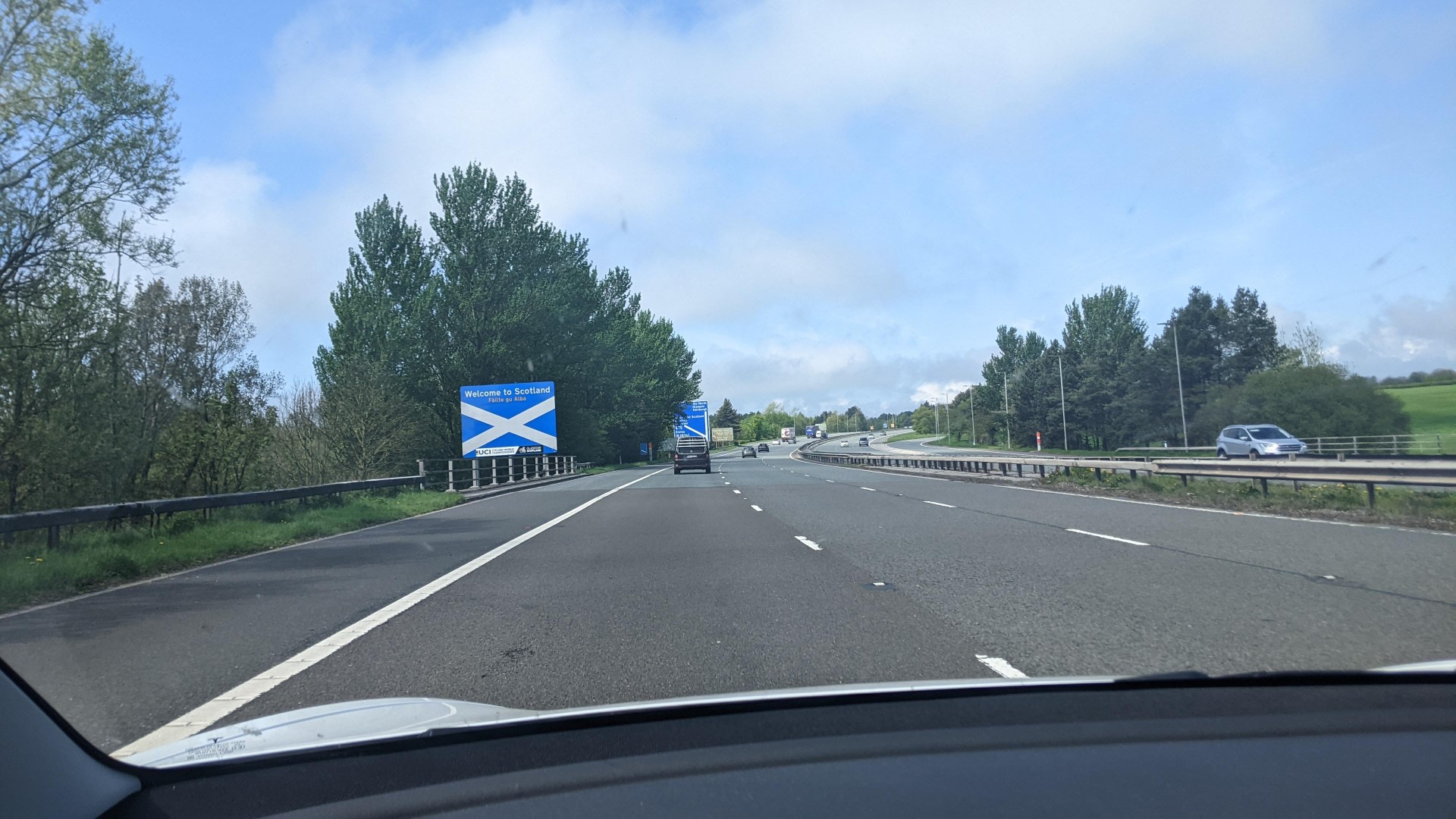
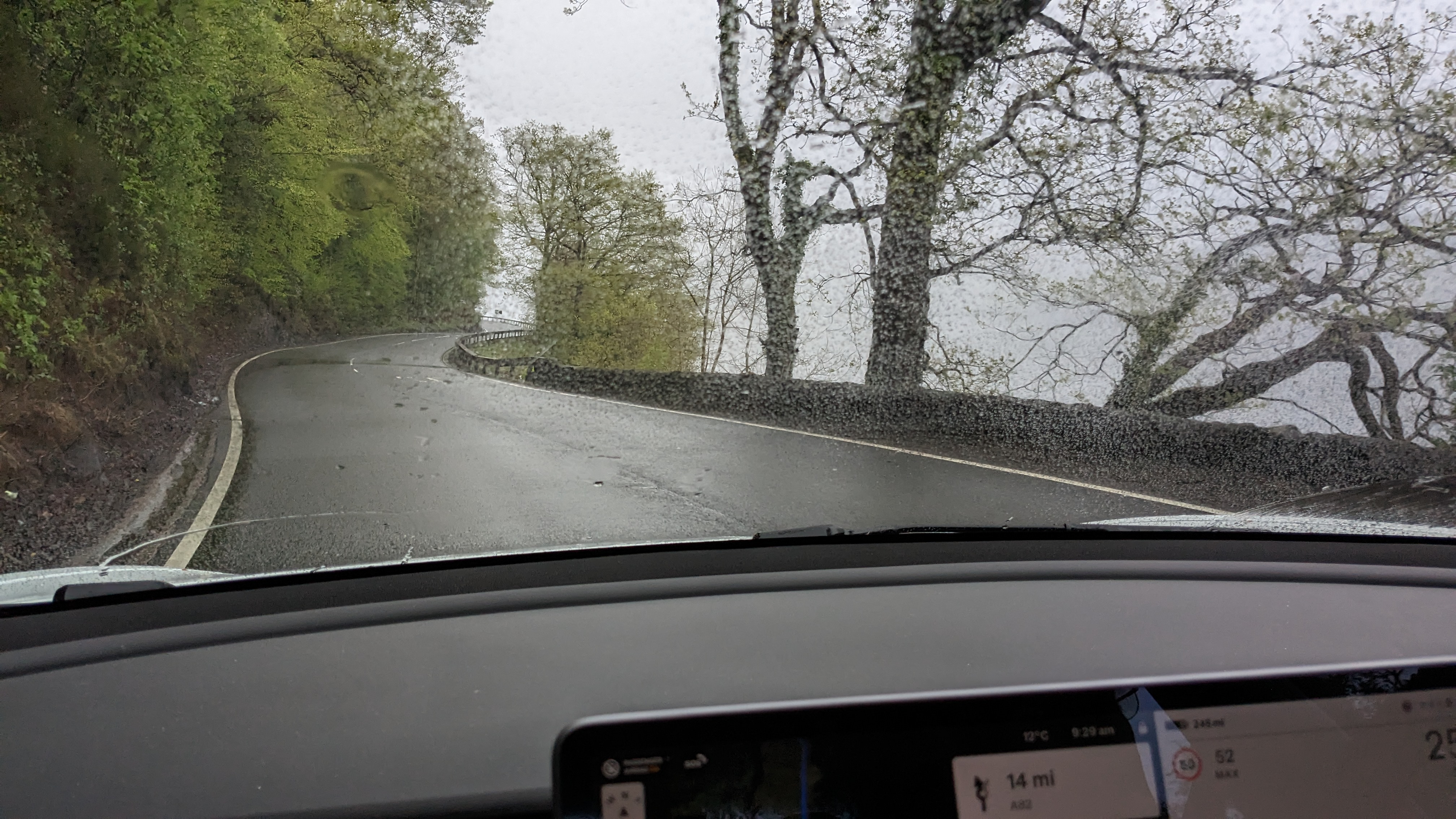
We started early on the Monday morning for the final leg to the Oban ferry terminal from Glasgow. We didn’t see much of Loch Lomond’s bonny bonny banks, or anything else for that matter, as it was raining and misty all the way, but what the hell, we were on holiday.
That stage of the journey took a little over two hours and we arrived at the terminal with two hours in hand before departure. Part of that time we spent drinking coffee, finding a paper and exchanging the vouchers provided by Hebridean Hopscotch (our excellent Lewis-based travel agent) for the tickets and boarding cards we would need for the four ferry crossings on the journey ahead.

It had been my intention to try out the ChargePlace Scotland charger at the terminal and see if the contactless card I had been sent worked, but when the check-in man in his control box raised a barrier to let us get to it, the unit recognised my card all right and asked me to connect, but it turned out that another car was using the CCS connector that we needed.
When the owner of the car came back he showed me that there was actually an auxiliary outlet on the side of the unit that I could have used with the connector cable the Tesla carries in its frunk (i.e. front trunk), but by then, as we had almost 200 miles left in the battery from the Abington top-up, I decided to leave charging until the islands, graciously yielded my place to couple in an electric Jaguar whose need seemed more urgent (thus contributing to the camaraderie of EV drivers) and moved the car straight into the ferry queue.
I should mention that a background theme for this whole trip was to share with my wife something of the four Hebridean sailing trips out of Oban’s Dunstaffnage marina I had with medical-writing colleagues from Glasgow – in days gone by when I used to fold more neatly.
That made it a deeply nostalgic experience sailing through the Sound of Mull and out past the Ardnamurchan Point lighthouse which I once spent what seemed like most of a day battling past into the teeth of a westerly gale. People who shared that trip laugh to this day at the memory of me standing at the wheel steering into the huge seas and saying how odd it was that we were allowed to do that sort of thing when we weren’t allowed to buy more than a dozen paracetamol.
Sadly on the present occasion, the iconic profile of ‘Eigg on the starboard bow’  (as in Speed bonny boat, etc.) was completely hidden in the mist. Similarly Muck and Rhum, names to conjure with, but not, this time, sights to be shared. So Lesley and I settled down to reading, buying things from the bar and occasionally leaping up to gaze in directions people said they saw dolphins.
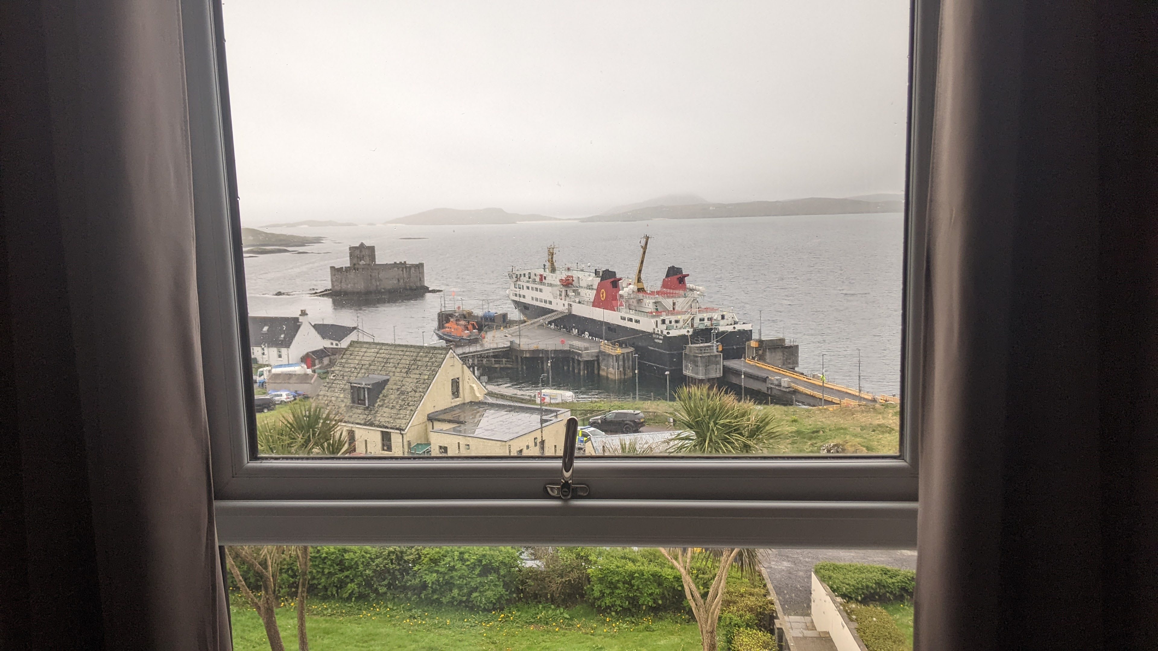
At least the journey was reasonably smooth and it didn’t seem long before land was in sight and we were coming into Castlebay on the Isle of Barra. Past, you may not be surprised to hear, the castle in the bay. Then it was down to the car deck, wait for the ramps to be lowered, and then out onto the jetty.
The Castlebay Hotel we were staying at overlooks the harbour and was ridiculously easy to find. So we parked in front, carried bags up the steep steps, checked in and were shown into our room, with a view from our window of the boat we had arrived on.


Continues in next post…
